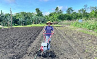
The objectives of SMARTseeds Project are to develop and deliver information services that provide a location-specific recommendation for vegetable farmers, particularly chili, tomato and cucumber farmers based on a combined use of satellite data and field survey, to help increase productivity and at the same time reduce cost for input. Based on the baseline survey, SMARTseeds Project provides the following information services needed by farmers:
- Soil nutrients and fertilizer recommendation
- Climate/seasonal forecast
- Daily/short-term weather forecast
- Pest and disease advice
- Irrigation advice

Soil Advisory
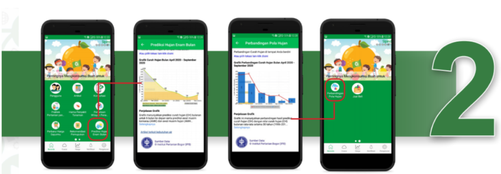
The seasonal climate forecast is generated using the output from global climate models for seasonal climate predictions. These results were statistically modeled to predict various regions in Indonesia. The information resulted from this model are rainfall forecast for six months, rainy / dry season onset and the comparison with 30-year climate data in the separate features. The seasonal climate and rainfall prediction with 30-year historical data are available for all of the southern part of the equatorial line of Indonesia.
Rainfall Prediction and Comparison with 30-yearRainfall Historical Data
The seasonal climate forecast is generated using the output from global climate models for seasonal climate predictions. These results were statistically modeled to predict various regions in Indonesia. The information resulted from this model are rainfall forecast for six months, rainy / dry season onset and the comparison with 30-year climate data in the separate features. The seasonal climate and rainfall prediction with 30-year historical data are available for all of the southern part of the equatorial line of Indonesia.

Daily Weather Forecast
The Daily Weather Forecast feature was added into Sipindo powered by SMARTseeds on the second phase. It provides daily weather information for maximum the next 9 days with 9 km spatial resolution. This feature is a location specific information including rainfall amount, temperature, wind speed and wind direction information.

Pest and Disease Information
In cooperation with the expert team from Gadjah Mada University (UGM), EWINDO has further developed the Pest and Disease database to provide both chemical and non-chemical advice to farmers in order to control pests and diseases.